
It’s essentially an open source fork of maps.me by the original creators.
I’ve been using OSMAnd for years, but it always felt laggy and not that reliable. Searching was slow and so on. Many street or things it didn’t instantly find.
In the Graphene App Store I jnust discovered Accrescent (another app store thing but only with like 10 apps - they’re all gold though, god damn)
An in there I found organic maps. And this shit is google maps level responsive. If you’re on the lookout for a google maps replacement - consider trying this.
Byeeee
100% agree with this post. Mostly using google maps now for car route planning (still unbeatable in rerouting in case of car accidents etc. afaik).
In Berlin it was missing some public transportations like tram
Does it know how to navigate NYC public transit? That’s a big use case for me. I don’t need driving directions. I need to know which subway is closest.
It’s my go to! Also check out the [email protected] community
Edit: sorry, it looks like the more active community is [email protected] but I guess you can join both lol!
Yep, the best of the best :)
Shame it doesn’t do street numbers (possibly an OSM limitation?). Other than that, solid.
You need to go around with street complete and add numbers. It takes time but it is fun and good exercise.
Many street numbers do not exist in OpenStreetMap because no one created them! So if you know about some area with this issue, help edit the map!
StreetComplete tasks got my neighborhood to be the best-mapped little village I’ve ever seen! 😎
Since I’m walking around for exercise anyway, I’ve got most of the addresses, and now I’m working on the fire hydrants.
Lots of places have street numbers (I can see them on the map) but for some reason don’t come up in search.
I use Magic Earth because, for some reason, it doesn’t have this problem.
I also use GMaps WV to get the address from Google and then just share it to another app.
Depends what you mean with “doesn’t do”. I haven’t used Organic maps that much yet, but OSMand can handle street numbers. So Organic maps should too.
However it handles them very poorly, you have to type the address in a certain way or it won’t recognise the number in it. Sharing from another app works pretty well most of the time though.
I just started using it, and I would say it’s even snappier then G Maps. I was pretty skeptical at first, and it does have a few things I miss, like public transport live updates, but I can use the app of the local provider for that and in my experience G Maps can be quute inaccurate anyway. No way I’m going back now. You need some space to preload the maps though.
For driving I recommend Magic Earth, it’s based on OSM data but uses proprietary traffic information as well
Yeah, you can see that organic maps is sadly not there yet in terms of driving-interface, but hopefully its getting there soon.
Afaik the app is far younger than magic earth and for what it is its super good. I’m so stoked to see how organic maps is gonna develop in the coming years
If we don’t need traffic Information Organic maps is fine too. It now even says where you have to turn which is a major improvement.
It now even says where you have to turn
Only if the map has road lanes defined. That means: everybody join OpenStreetMap and map your local area! :)
Didnt knew that. Good that I regularly try to add more data to OSM.
If you use Android, there’s a fun app called StreetComplete that helps you adding details to your neighbourhood
Magic Earth is not an open source app. They haven’t released any source code. Mentioning it as the OP title is about open source maps app.
https://www.magicearth.com/faq-en/
Will Magic Earth be Open Source?
No; since it is also used commercially (we have a paid Magic Earth SDK for business partners), we cannot make the code public.
That being said, I love using Magic Earth for driving. It works quite well as long as your area is up-to-date on OSM
Proprietary software that collects my data, no thanks. It was fine when there weren’t any alternatives but that isn’t the case anymore.
How will they get traffic data if they don’t get the data of their users? I understand being privacy conscious, but some data collection can actually make sense.
They don’t
I don’t want my location tracked all the time always
Do you carry a cell phone at all?
I use Organic maps which runs local
Will check this out, thanks for the recommendation!
I second magic earth for driving. The only reason I haven’t entirely removed Google maps from my phone yet is because magic earth doesn’t have data on business hours. This is the last killer feature I’m waiting for.
In the meantime I’m routing for any open source map that can do live traffic and business info.
I use gmap wv for that. It’s just the web view of google maps but works better than Firefox and easier to pull up when osm fails. Navigation obviously doesn’t work but should satisfy your use case.
Could just use yelp or a browser for business hours.
Honestly, I uses organic maps and if its not mapped I just go on the business website. Fuck google, thats why!
Interesting. Do you happen to know where it gets its traffic data from? I haven’t yet personally found anything nearly as useful as Waze.
My experience with Waze was inferior to Organic Maps.
Interesting. How so?
They collect location of their users but anonimize every data on device, they can’t track anyone personally. They also sell their SDK to businesses and collect data from there as well.
But I don’t think Magic Earth is that widely used. How precise is it really?
I use it frequently, and it’s mostly right. It can tell traffic jams really precisely (it says something like “you will have to stop in 300m” and the traffic jam is actually starts at ∓10m from that point)
But it tries to navigate me through fully closed roads. I don’t know why is that. The kind of closed road it misses is regularly closed, but at irregular intervals (like most weekends on the summer, but not always, if there is some happening it is also closed on weekdays, etc). These kind of irregular things shouldn’t be mapped in OpenStreetMap (As documented in the wiki) I have a feeling that they think that it should be mapped, but I won’t map it.
I guess it also depends on where you live, so just try it first.
Honestly, when a road is closed for a weekend at irregular intervals without a schedule in advance its not reasonable to map it. I contribute to OSM from time to time and thought about it as well but the general consensus is to map regular closures or road closures that go on for like more than a month. OSM is a general purpose map and not for mapping road closures as current data will be used long after now on offline navigation gps devices. We would probably need an open street closure map that aggregates all the databases for road closures and interact with osm. For the major ones I know I’ve just been blocking what I know locally to not route through it, as I can’t be bothered in starting a project like that
Given they are working with third party for traffic data, it should be theoretically possible for them to exploit ad network or work with google for mobile locations.
From reading the Magic Earth FAQ, I believe the user data actually isn’t used for traffic at all (at least the manually reported events certainly aren’t).
Edit: never mind I missed a later part in the FAQ:
Do you share data with third parties?
We send position data to our traffic provider to generate real-time traffic information. The data is anonymized on the phone, using a changing key (so it’s not linked to you), and it is deleted after 5 minutes.
Does it have temporary speed traps and trajectory based traps?
I often drive in the middle of the night and speedlimits make me fall asleep.
That is an impressive grade of bullshit.
How well has that particular excuse worked with law enforcement in the past?
What? I’m asking a question. I don’t need your opinion.
is it on fdroid or do I need to go to github
Organic Maps is my goto solution for car navigation because it is very quick, responsive and does not require an high end phone. It just works. However for anything more advanced than that (e.g. live location sharing or recording, planning a hiking trip, navigating mountain bike trails, contributing to OpenStreemMap), OSMAnd is still without contender.
I’ve used organic for several hikes. What was missing?
Here a a few things that I miss from OsmAnd:
- adding more than a handful of routing points is tedious
- you cannot plan partially or fully independent from existing roads
- no way to save and restore a planned trip
- no overlays for hill shading or incline visualization. Very useful for assessing the effort of a route.
- no public transport support. Very useful for planning a trip with transitions.
- no rain radar
- satellite view
For me, it’s even better than GMaps, because it lets me navigate on bike paths, which GMaps couldn’t.
Wow that genuinely looks unbelievable!
It’s like an old mall or whatever map except without you are here and movable!
What until you discover OSM (that’s what Organic maps uses)
Idk … In their description on f-droid they crossed out “no pesticides” and wrote “purely organic” … It implies they are using organic pesticides. Not sure if that’s something for me tbh.
Edit: screenshot added
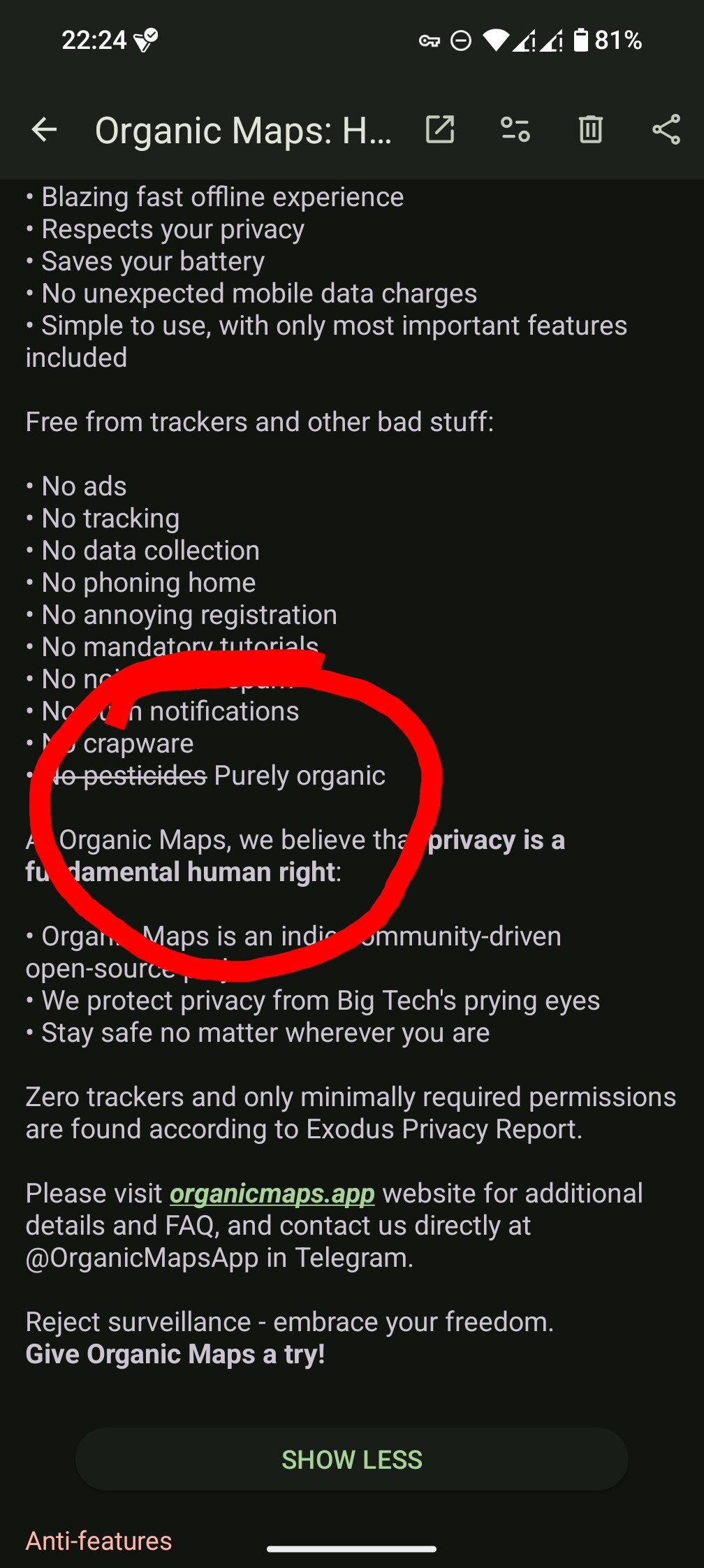
Exactly …
Caffeine and nicotine are legit organic insecticides, that might be a deeper joke about coffee and cigarettes powering development
Great point of view
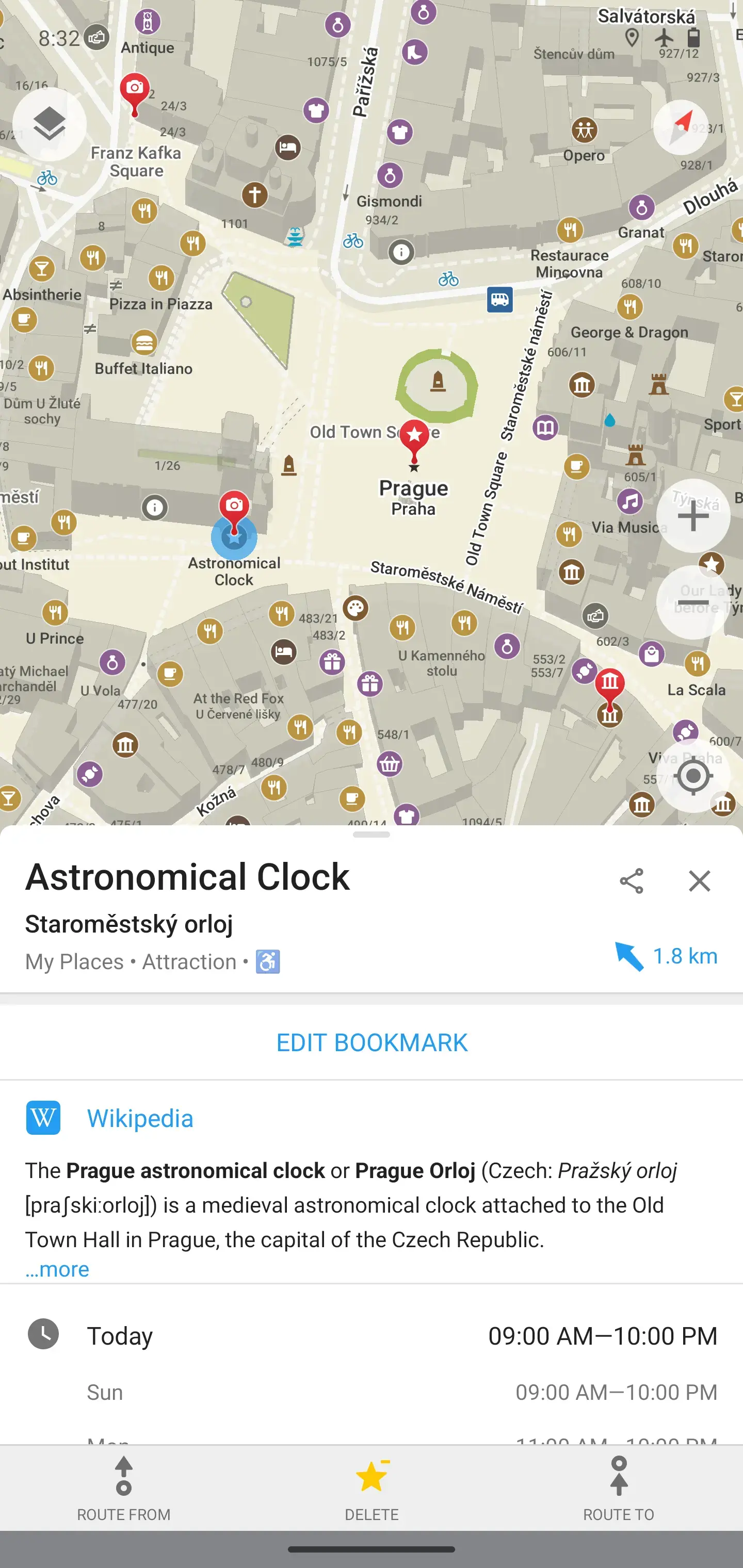
so i opened this app for the first time just now and entered my address, but it only went to my street. when i tap my house, it just says “building”… is there no residential support?
Depends in where you live. For instance in Germany house numbers are associated with the building but in France house numbers are their own object. The Idea there being that one should map the location where the plate with the houseumber is, and not the building(s) its associated with. If you dig throug osm map forums or issue trackers you’ll find the dispute resurfacing every now and then.
Ok downloaded. Seems very nice!
Still working out how to get directions but all things in good time.
It is great. But too bad for me - I live 40km away from the nearest town, in the forest of northern Sweden. So the coverage here is quite not so good. Practically all I see is the main road.
You can actually contribute to it. There areso.me great mobile apps for this. I recommend Vespucci for in detail changes(creating new structures or editing their properties) and Street Complete for filling missing information.
It’s open street map data. If there isn’t mapping info for your area, you can fix that.
Specifically for Prague (ha! I’m here now) mapy is insanely good


