The app is showing provincial and national for me. I’m in NS and have a few around the city and they aren’t mislabeled from what I see.🤷🏻♂️
Either I’m the odd one out or they changed it back.Edit: found one, how have you been reporting this?
Just the provincial parks? I was about to get out the pitchforks, but if it doesn’t include national parks that seems unrelated to the drama.
Just label the US as South/Lesser Canada.
The Gulf of Lesser Canada does have a certain ring to it…
Came here to talk about this as well.
deleted by creator
decades
Years
deleted by creator
What’s the issue here? Are they not State parks?
State parks in a country with no states?
Your country is a State
But these parks are run by the provinces, not the Canadian government. The only parks in Canada that could be called “state parks” would be those run by Parks Canada.
It’s not. Never was, never will.
you misunderstood what they meant.
all countries are states. a state is an entity, some states band together into a federation of some sort. some are unitary, some are not. unitary means the same laws apply in all places, others have regional autonomy.
canada is a state, with subdivisions that it calls provinces america is a state, with subidivisions that it calls states russia is a mafia pretending to be a state, that has oblasts and others
That comment was “we aren’t going to become the 51st”
Someone doesn’t know English. Or are you saying that you dont have sovereignty?
How are you this ignorant of current events?
You know what you said, we know what your goal is. Let’s not confuse the multiple meanings of the word “state” here.
Fucking chud. Stop being an ignorant pedant.
What seems most likely to me is that some of these had the State Park category on Google Maps for a long time, and now it’s being noticed. They say the “Provincial Park” category was removed, which implies it used to be an option.
There’s a bit of variation between types of park, even found a provincial park that is labeled both national park and just park, depending on where in the UI you find it.
Images contained in spoiler tag:


Labeling was probably never reliably strictly correct, but removing Provincial Park as a category is a little hostile, considering the timing. (Assuming it used to be an option, and Samantha in the video isn’t entirely mistaken.)
…actually, this is at the bottom of the article:
“If you ever see the extremely rare ‘provincial park’ used as a category, this was imported automatically by Google using the old Google Map Maker categories. They have long since simplified the categories (there used to be many hundreds of obscure categories) and provincial park is no longer an option when adding or editing parks,” she said.
It doesn’t make much sense to remove “Provincial Park” when there are so many specific variations when you go further down to regional, municipal, city, community, etc. parks and they have a bunch of very specific (and often unrelated) park categories. Here are a few that are near me:
- Park
- Ecological Park
- Memorial Park
- City Park (none of which are near a city, run by a city, or even a municipality)
- Hiking Area
- Playground
We don’t have states. They would be provincial, territorial or national.
Do you know the definition of State? The government of Canada is a sovereign State.
Ask yourself “why is Google doing this now?”, “who asked for this change?” and “what does Google gain from this change?”.
Don’t be obtuse.
Seriously, that’s not how that works, and it’s not how Canada has them listed.
Jesus fucking Christ already!
The orange butt plug and fElon need to keep their fucking hands off Canada.
I wouldn’t be surprised if the orange utan asked Google to “make a mistake” on purpose, to float the idea and see what would happen.
Can you please go burn down the White House again?
Canada really needs to develop its technology to get off of oppressive American tech. We need to work with other countries and develop our own tech to combat this. Absolutely insulting. Just a little “oopsie” after over a decade of not having mislabelled parks? The stink is showing.
The geodata and related open source technology to edit, review, and host it is already available from openstreetmap community
A government funded utility that utilizes regional GIS and aerial mapping would go a long way. Google’s got the upper hand on directions and traffic reporting though, so that would take more time to make effective. A lot of that is genuinely due to the number of users that exist on the platform though. I think if you tried to implement similar location data analysis for government infrastructure, people would be up in arms at the idea, despite being perfectly happy to provide the same data to Google.
It’s unfortunate that Google is as prevalent a default service as they are, but it’s hard to ignore how good a service they offer, and how long the development period has been to get them there.
just scrape the traffic data, it’s what they would do.
Yeah people have to start using OpenMaps more, and OSMAnd app alternative for navigation
I also recommend Magic Earth, I find the navigation to be more reliable than OSMAnd+
Yep! I recently created an account with https://www.openstreetmap.org/ and started mapping my local area. Fuck Google.
I have been using the StreetComplete app that ties to that. It is actually helpful because I noticed some bad information on the local maps that was very easy to correct in the app.
Yeah! StreetComplete is great! They really make it easy to improve the maps. It’s even motivated me to get out and walk more so I can complete the little quests.
Relevant communities:
We have. Only it’s not well known, because of Google’s monopoly.
Then let’s start naming them and putting them out there. If they’re just maps but we need guis for apps on these, then it’s a great time to start that process and get developers in on it, preferably open sourced if possible.
My guess is there would be lots of developers willing to work on a project like this to help distance us from America.
Organic Maps and OSMAnd are phone apps. You can use Street Complete which is like Pokemon GO but improves the maps in your area.
Open source options exist. We just need more people using OpenStreetMaps and shit.
As much as i try to update OSM with local knowledge, there’s no way to keep OSM reasonably up to date without automation tools.
I’m not sure how OSM can replicate whatever tools google uses to constantly update open/close hours, new/dead businesses, bus stops with schedules, etc.
This is all just crowd sourced no? Like after I visit a place google will ask me a bunch of questions about it (eg. “Did they sell X here?”).
Atleast in India, Gmaps isn’t updated on local info either. OSM is barren in comparison.
There’s maps.cz, somehow has more local data (like hiking trails).
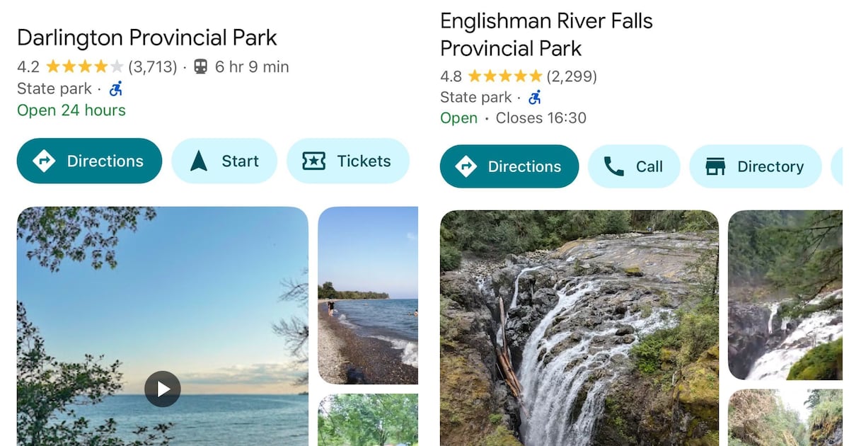
Just checked and sure enough, nearby provincial parks are labelled ‘State Park’
Time to update your community on Open Street Map and start using Street Complete so people around you can switch to Open Street Map apps. All it takes is a couple active editors to make a town viable.
Example:
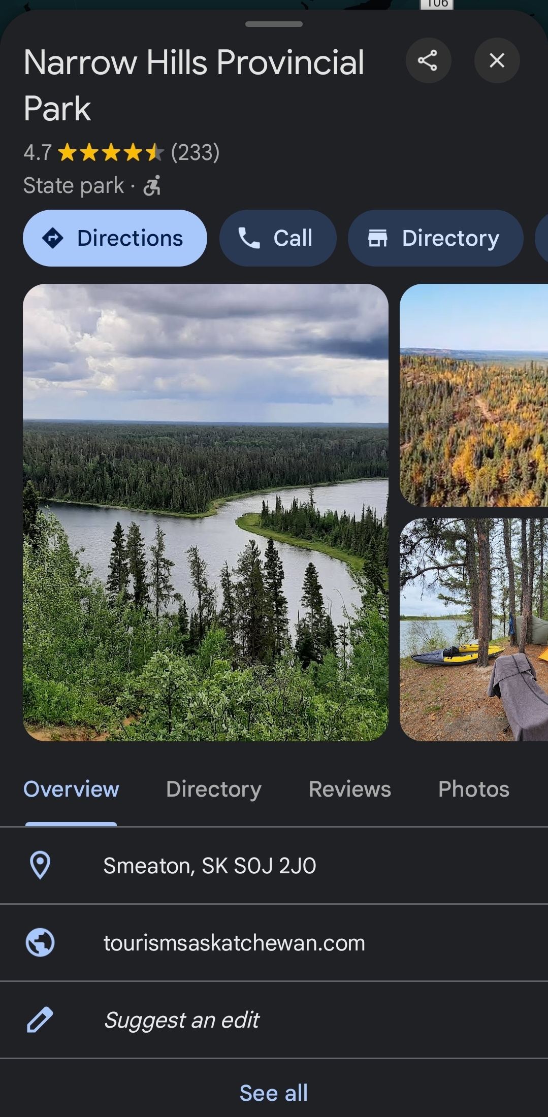
Just says Park for me?
May as well start calling temples “churches” and change all speed limits to Mph since it seems we’re in a “being wrong” contest.